|
MAYFLOWER - NAVIGATION
Please use our A-Z INDEX to navigate this site or return HOME
|
|
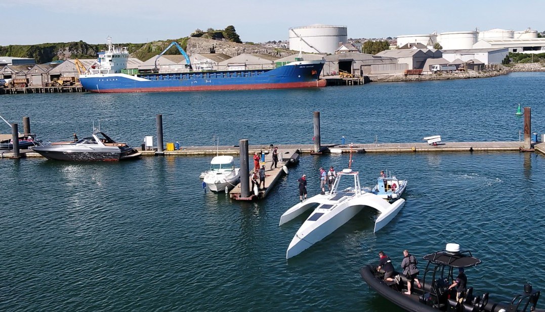
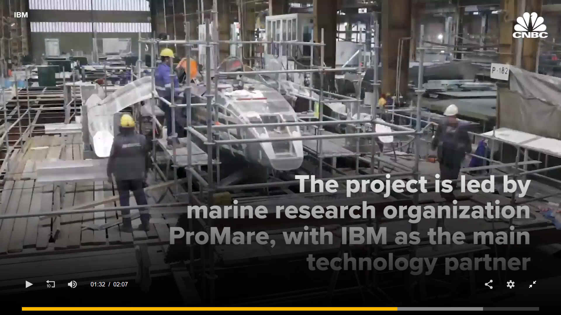
MAYFLOWER TRIMARAN - 1. The solar-powered research boat will aim to traverse the Atlantic Ocean in 2021 with no humans on board. 2. Sea trials are due to commence off the south coast of England in late 2020. 3. The Mayflower was officially unveiled on September 16th 2020, the 400th anniversary of the original Mayflower departure.
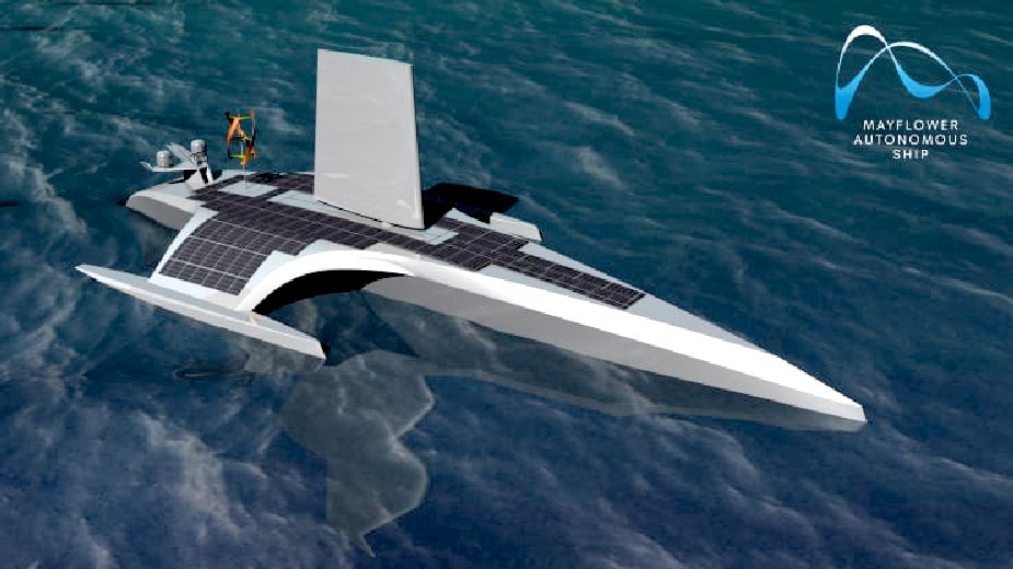
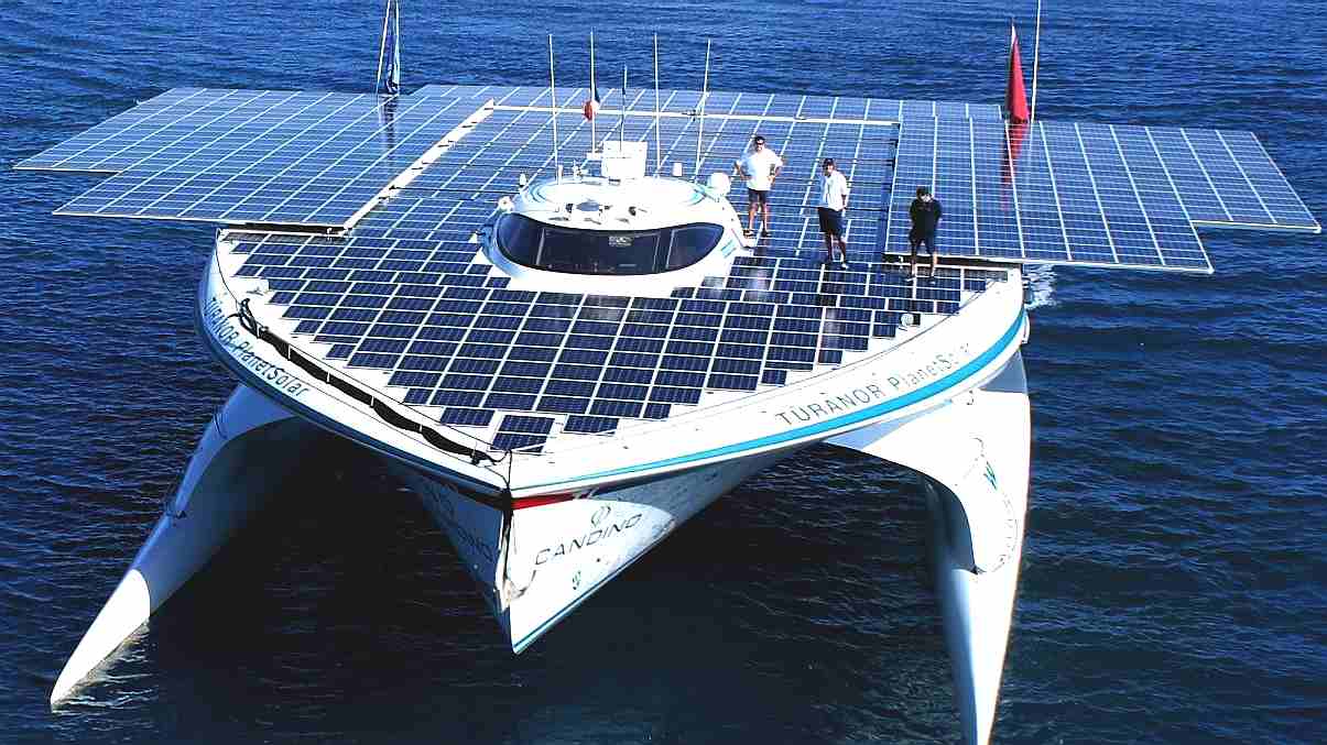
According to their information, the Mayflower is powered by AI and the energy from the sun and a small wing-sail. The autonomous boat, is a trimaran similar to the Cable and Wireless Adventurer in design - about one third the length - designed for long durations at sea with the object of collecting data about the ocean.
The vessel will make its own decisions on its course and collision avoidance, and will even make expensive
satellite phone calls back to base if it deems it necessary.
Data on hundreds of ships has already been collected in Plymouth Sound to feed its machine-learning algorithms. * Graphics processors to process images * Computers to process information and run programs
MAYFLOWER AUTONOMOUS SHIP (MAS)
An unmanned research ship presents many technical challenges.
The MAS needs to understand its overall mission and destination but must be able to constantly update its route to gather the most valuable data in the short-term.
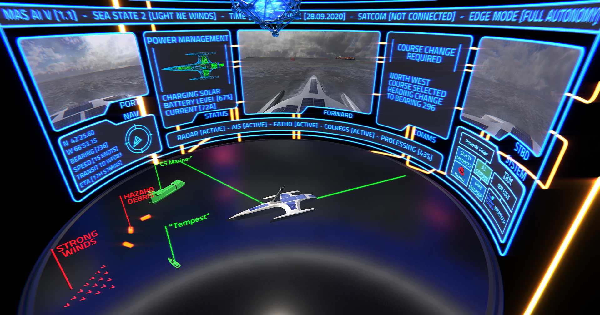
- Onboard cameras provide visual input to an IBM computer vision system which identifies hazards like - cargo ships, fishing vessels, and even partially submerged shipping containers floating in the water.
- Automatic Identification System (AIS) provides specific information about the other ship’s class, weight, speed, cargo, etc.
- GPS Navigation System provides MAS’s current location, heading, speed and course.
- MAS’s nautical chart server provides geospatial information about its chosen route.
- Weather data provided by The Weather Company.
- Attitude Sensors assess local sea state (how MAS pitches and rolls due to waves).
- Fathometer provides water depth measurements.
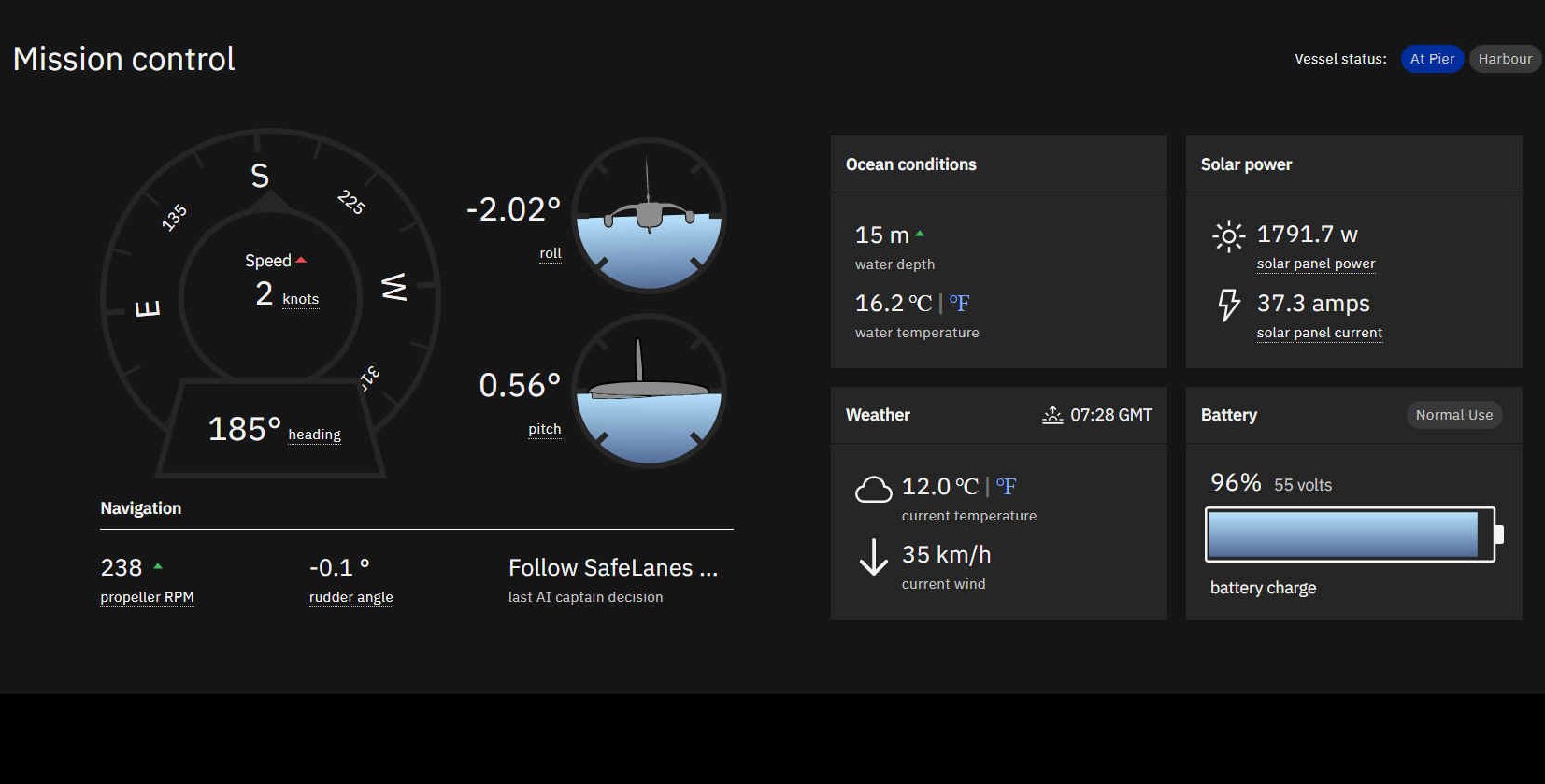
- Vehicle Management System provides operational data such as MAS’s battery charge level, power consumption, communications, science payloads etc.
HOW IT WORKS - Using a hypothetical example: "let’s assume that MAS is in the open ocean, approaching Cape Cod, with no current network connectivity. In its path ahead is a cargo ship which has had a collision with a fishing vessel and lost some of its load. In this scenario, MAS’s AI Captain will use a host of technologies and processes to independently assess the situation and decide what action to take, without ever connecting to a land-based mission control."
IBM's Operational Decision Manager (ODM) evaluates COLREGs with respect to the other vessels in the vicinity and generates a risk map indicating an “unsafe” situation ahead - if there is one.
OBJECT RECOGNITION PROGRAMMING
Over two years, the Mayflower team has trained the ship's AI models using over a million nautical images collected from cameras in the Plymouth Sound, as well as utilizing other databases. The Team used an ABM Power AC922 with IBM Power9 CPUs and Nvidia V100 Tensor Core (graphics) GPUs, the same technology behind the world's smartest AI supercomputers. Using IBM's computer vision technology, the boats AI Captain should be able to detect and classify ships, buoys and other potential hazards such as land, man made obstructions and ocean debris.
Mayflower is significantly larger than the Scout from 2013 and Solar Voyager, a kayak from 2015/16. Both projects were designed to navigate The Pond autonomously on a low budget, but did not make it. They were small enough not to be designed for COLREGS compliance. Though, other military craft have surmounted that issue.
LINKS & CONTACTS
https://mas400.com/ http://www.promare.org/projects/
|
|
|
Please use our A-Z INDEX to navigate this site
This website is Copyright © 2020 Jameson Hunter Ltd
|