THE TRADE WINDS


Please use our A-Z INDEX to navigate this site or return HOME


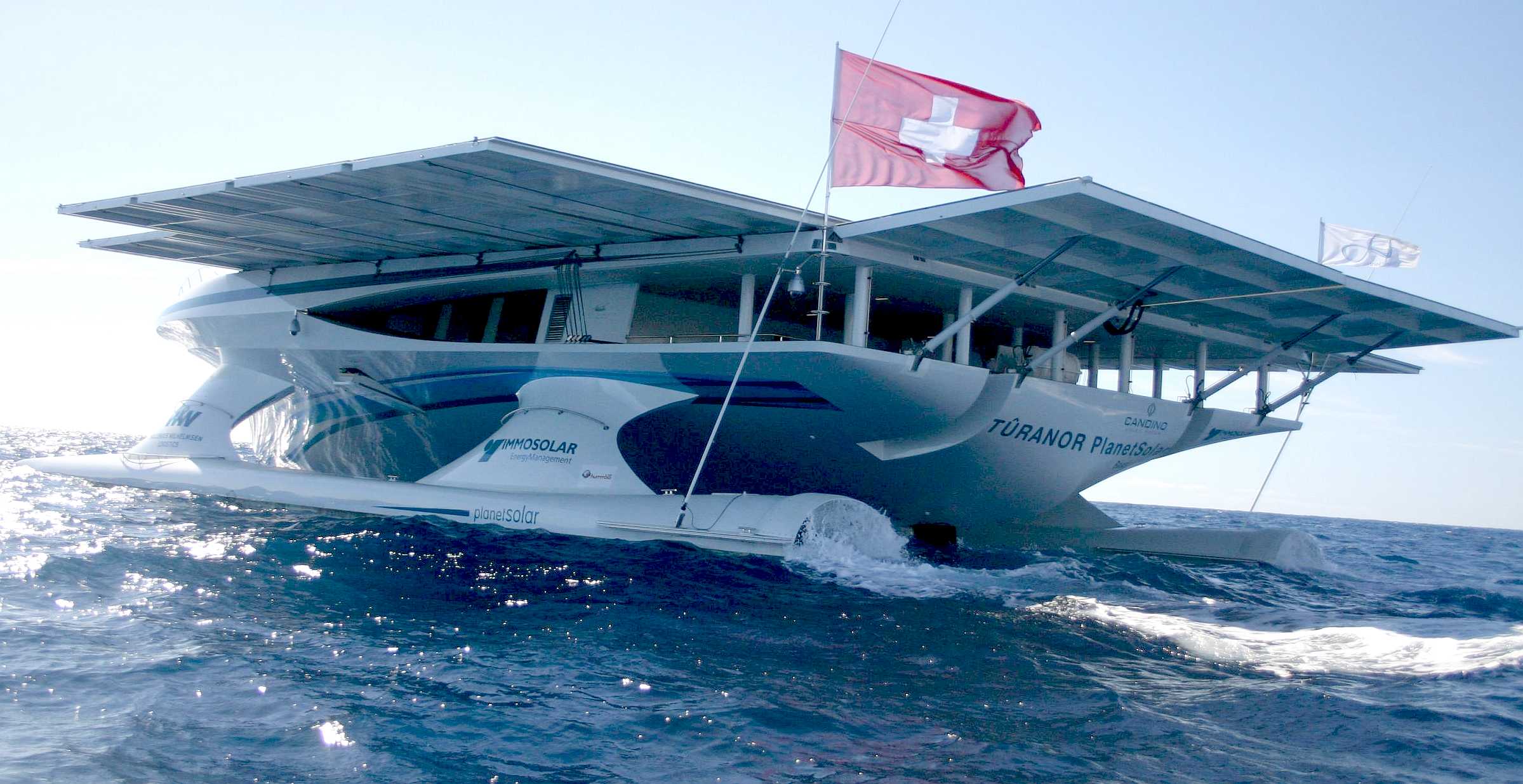
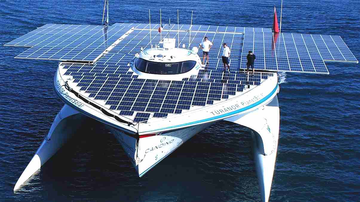
PlanetSolar heading out into uncharted technical waters. The theory was in place, but nobody knew if this solar powered boat could make it. But they did! The solar panel area on this ship was increased with solar panels on rollers, pulled out by the crew using winches. The Elizabeth Swann uses robotics and hydraulics to move solar wings that automatically track the sun, and fold away in storm conditions. PlanerSolar did not seek to advantage itself of the trade winds, except by the shape of the hull and the rear wing that could be raised for some slight sail (drag) effect.


Weather plays a large part of any Atlantic crossing using wind power, such as with a sailing yacht:


1. Deciding when to go,

2. Which route to follow and 

3. The sails to carry.


The main consideration for leisure sailors is to avoid the hurricane season from June to November. So most yachts leave in late November to arrive in time for Christmas. Although the trade-winds in January are often stronger. Of course you have to know how to sail, trim and tack your boat. It takes a lot of work and constant vigilance.


With a wind turbine, or rotary sail, such considerations are irrelevant.


There are lessons to be learned from yachties, lost on many ship captains today, who simply ignore what Christopher Columbus and Vasco Da Gama learned the hard way. If only we could take out much of the guesswork. It is well worth considering such a problem as if we were reliant on sails.

For example, it is human nature to push boundaries and some yacht crews leave early to get a longer sailing season. The earlier you leave, though, the more important it is to stay east before committing to a westerly course. Late hurricanes generally develop to the west, making a passage via the Cape Verde islands more attractive. It shortens the time in potential hurricane areas and offers an escape route south as hurricanes rarely track south of 10°N.


During a typical crossing, the trade-winds will be Force 4 or 5, with some lighter periods and a few days of winds of 25-plus knots. A flexible sail-plan is necessary to take account of the changing wind strengths – there is no one-size-fits-all answer. The most common sail-plan is goose-winged (sails out on either side of a boat), with most skippers carrying a specialist downwind sail for when the wind goes light.


The main peril of sailing downwind in a breeze is rolling. It may start gently but within seconds you can be rolling from rail to rail and a moment later she rolls too far.

Because squalls are common and can have gale-force gusts on the leading edge, it is important to be able to reduce sail quickly. Boats with only asymmetric spinnakers tend to struggle in strong downwind conditions, so always carry a whisker pole to pole out a headsail as well.

Sailing hot angles may work for a lightweight flyer, but it adds a lot of distance. For a heavier cruising boat it is hard to gain the increase in speed to compensate for the extra distance. Once hull speed is reached, a shorter route will always be faster.

With well-established high pressure, a direct route is usually fastest, staying far enough away from the high to keep the wind, but minimising distance. However, the less established the high is, the greater the chance of a mid-Atlantic trough or low developing, giving adverse winds. In this case a more southerly route is better. A sailing boat does not have solar panels to motor out of difficulties.

Racing sail boats often take the northerly route and the faster the boat, the more likely this will pay off. However, it runs the risk of meeting depressions which develop mid-Atlantic. Hence, stay away from the middle of the ocean, except where there is no wind at all, and incoming solar radiation is strong.

Lulls should not be underestimated and the potential gain of passing north of a depression must be balanced against the risk that it could deepen and track across the route. The route is also more prone to a northerly swell.

The southerly route, offers lower risk, with steadier trade-winds and less chance of an uncomfortable northerly swell.

The choice of route for sailing yachts may depend on fuel capacity and a crew’s willingness to use a polluting diesel engine. This is not an option for a solar/wind powered craft, that is designed with battery reserves to overcome inconsistent weather patterns.

Seasoned sailors will know that no two times over the Atlantic are the same. There can be a great deal of variation. Following weather forecasts are important. There needs to be some flexibility in the route to take account of forecasts and how they change over time. This is something the Cleaner Ocean Foundation are trying to reduce to an absolute minimum.


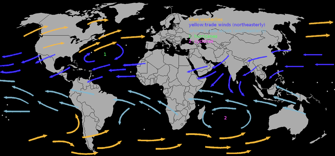
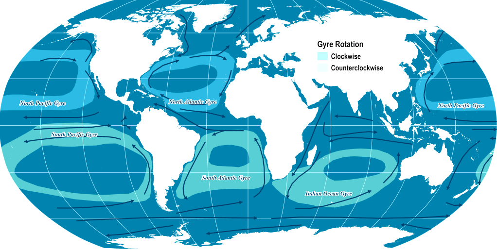
Map of the oceans, showing the trade winds. The global oceanic system has five major sea current gyres that act as large conveyor belts.


The gyres are also correlated with dominant wind flows where they rotate clockwise north of the equator and counterclockwise south of the equator. During the era of sail ship navigation, these gyres had a strong impact on navigators and trade flows.


TRADE WINDS & OCEAN CURRENTS


The trade winds or easterlies are the permanent east-to-west prevailing winds that flow in the Earth's equatorial region (between 30°N and 30°S latitudes). The trade winds blow mainly from the northeast in the Northern Hemisphere and from the southeast in the Southern Hemisphere, strengthening during the winter and when the Arctic oscillation is in its warm phase. Trade winds have been used by captains of sailing ships to cross the world's oceans for centuries and enabled colonial expansion into the Americas and trade routes to become established across the Atlantic and Pacific oceans.

Thanks to the unequal heating of Earth’s surface and its rotation, these winds blow in different directions. The Earth is warmer at the equator than near the poles, which puts air in motion. At the equator the planet’s heat causes moist air to warm, expand and rise. At the polar regions cold, dry, heavier air descends.

This motion creates “cells” of rising and descending air that control global wind patterns. The Earth’s rotation dictates that different parts of the globe travel at different speeds. At a pole, a molecule of air would just spin around, while a particle of air at the equator in Quito, Ecuador, would travel 7,918 miles (12,742 kilometers) in a single day.

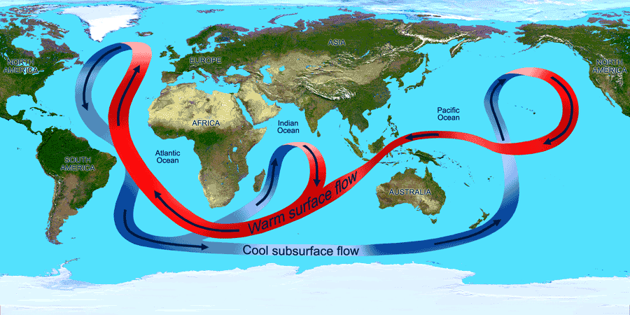
As air flows across the ocean’s surface, it moves water creating waves. This creates a circulating system of gyres, or rotating currents, that move clockwise in the North Atlantic and counterclockwise in the South Atlantic. These gyres are part of a global conveyor belt that transports and redistributes heat and nutrients throughout the global ocean.

The Gulf Stream, which follows the U.S. East Coast before heading east across the North Atlantic, is part of the North Atlantic gyre. Since the current carries warm water north, it is easy to see on false-color infrared satellite images as it transports heat northward. Like a river, it also meanders.


In order to make sense of all of these variables, we will need to combine information from the Elizabeth Swann's instruments, feed them into a database and access that data from stored patterns, combined with real time performance readings, to define the best route at any time of year for a solar and wind powered commercial vessel.


Ocean currents sometimes oppose wind direction, where warm water is does not always follow what might be imagined as a logical pattern. Like many processes in the ocean, salinity is tied to weather and circulation. For example, trade winds blow moist air from the Atlantic across Central America and into the Pacific Ocean, which concentrates salinity in the Atlantic waters left behind. As a result, the Atlantic is slightly saltier than the Pacific.


With the advent of the ages of steam and later technologies, we have almost forgotten the role that the Trade Winds in developing our global economy.


Please use our A-Z INDEX to navigate this site


  THE TRADE WINDS POWERED SAILING SHIPS FOR HUNDREDS OF YEARS BEFORE DIESEL ENGINES

This website is Copyright © 2020 Jameson Hunter Ltd